- Geomorphological development in Quaternary coastal plains
I'm interested in geomorphological development of sedimentary geomophology of coastal plain such as fluvial and marine terraces and alluvial lowland, which should be affected by Quaternary sea level change and tectonic movement. I try to clarify local to global environmental changes by reconstruction of detail sedimentary environmental transition of coastal plains. In addition, I'm interested in interaction between human beings and Quaternary environmental changes, and conducted geoarchaeological research on some Japanese archaeological sites. In particular, I am focusing on microtopography of alluvial lowlands, such as crevasse splay and natural levee, I have tried their developing history in detail.
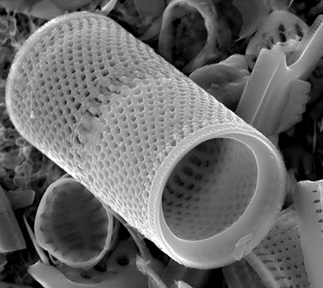
Diatoms are unicellular algae with two small siliceous valves ranging from several to several tens micrometers, and are found in various environments from marine to terrestrial areas. Although more than 20,000 species of diatoms have been described, it is sometime found diatom fossils from sediments that are difficult to identify. I have conducted taxonomic studies on such fossil samples, and also taxonomic and ecological studies of living diatoms inhabiting coastal environment such as marshes, lagoons, tidal flats and so on.
 GSJ Research Project
- Investigations on Geology and Active Faults
in the Coastal Zone of Japan(2014FY - present)
LINK (in Japanese)
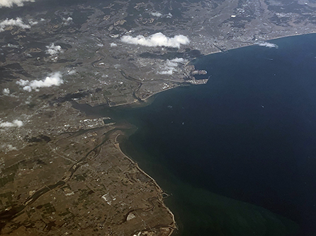
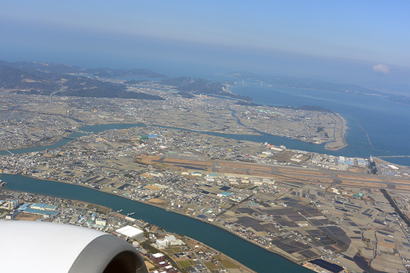
In the Japanese coastal plains, there are many industrial infrastructure and population. It is vulnerable to seismic hazards because they are composed of mainly soft muddy sediments. Therefore, information on distribution of subsurface geology is important for disaster prevention. However, geoinformation around coastal area has not been enough. In this project, researchers collaborate for describing "Seamless Geoinformation of Coastal Zone" by filling in the gaps. I have taken charge investigation on land area, and conducted survey the following areas.
- 2014FY - 2016FY: Sagami Bay (Ashigara and Sagami Plains)
>> Reports (published in 2021, in Japanese) - 2017FY - 2019FY: Ise Bay (Ise Plain, western coast of the Bay)
- 2020FY - present: Kii Channel (Tokushima Plain)
LINK(in Japanese) LINK (in Japanese)
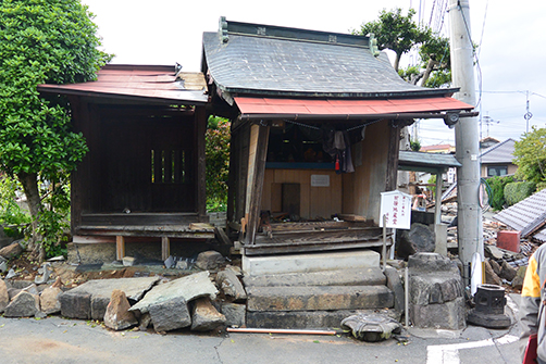
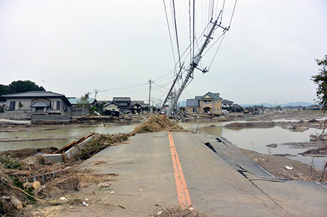
We conducted a survey on the distribution of house damage caused by the 2016 Kumamoto Earthquake, and clarified that there is the concentrated zone around Mashiki Town to western Kumamoto City. We conducted geological and geophysical investigation on the subsurface geology of the concentrated zone.
Grant
- Risk evaluation method for natural disaster considering geomorphic developmentLINK

JSPS, Grant-in-Aid for Scientific Research (B), 2018FY - 2021FY, Co-Investigator.
- Effect of changes in external factors on the activity of active faultsLINK
JSPS, Grant-in-Aid for Challenging Research (Exploratory), 2019FY - 2021FY, Co-Investigator.
- Examination of level 1.5 earthquake and tsunami in eastern edge of Nankai Trough, JapanLINK
JSPS, Grant-in-Aid for Scientific Research (B), 2017FY - 2019FY, Co-Investigator.
- Last millennium flooding history and geomorphlogical development of crevasse splay along Kinu RiverLINK
JSPS, Grant-in-Aid for Young Scientists (B)2016FY-2018FY,Principal Investigator.
It was found that the crevasse splay deposits of the 2015 Kanto-Tohoku Torrential Rain Disaster was divided into three units, which were corresponding to changes in flow conditions during the flooding. We conducted sedimentological investigation on a present flood deposits and coring survey in a crevasse splay distributed in central reach of Kinu River for clarifying geomorphological development and flooding history. Results of coring survey suggest that crevasse splay sediment was composed by more than three layers of flooding deposits which had deposited after ca. 800 cal. BP.