
Our planet has an area called the 'subduction zone', where tectonic plates subduct. There is a lot of movement going on here that has a significant impact on the world we live in. Our research into the geodynamics of subduction zones mainly uses numerical simulations (geodynamic modelling) to understand the long-term evolution of geological structures in subduction zones.
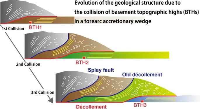
Multiple seamount collisions in a subduction zone
|
We used computer simulations to investigate what would happen to geological structures (accretionary complexes) that develop in subduction zones such as the Nankai Trough when sea mountains and ridges collide with continental margins as ocean plates move.
We found out how these collisions change the topography and how repeated collisions create complex geological structures such as those observed in the Nankai Trough.
This complex geological structure can influence the complex seismic activity in the subduction zone.
See: Miyakawa et al. (2022) We won the Seismological Society of Japan Paper Award for this research. [Seismological Society of Japan website] |
|
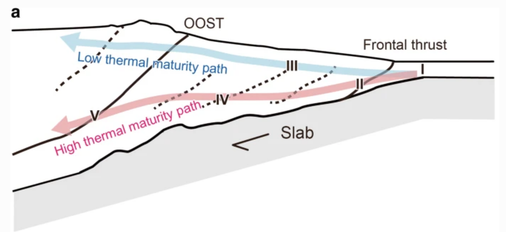
Thermal history during geological structure evolution
|
In the Earth, the deeper underground, the higher the temperature due to the Earth's heat.
We have simulated how geological structures (accretionary complexes) that develop in subduction zones grow and how much heat the sediments and rocks within them experience.
We have identified how the thermal maturity of the rocks varies depending on which path they take.
In particular, we found that even sediments of the same age, depending on how they were incorporated into the accretionary complex, were in some cases deeply buried, in others shallowly buried, and that the heat (thermal history) experienced by each was significantly different.
The thermal history observed at the Earth's surface reflects this difference in the experience of the sediments. See: Miyakawa et al. (2019) |
|
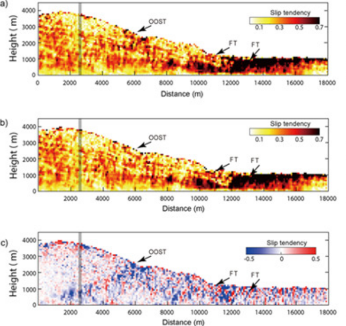
Force field (stress field) around a fault and fault activity
|
We used a numerical simulation to investigate whether the rock is slippery deep underground. Large faults form within the geological structures (accretionary complexes) reproduced in the simulation.
When a large fault is formed, we used slip tendency to evaluate the state of the force field (stress field) around the fault as it becomes active (displaced).
We found that before a large fault becomes active, the slip tendency of the fault increases locally around the fault, and that as the fault becomes active (slips), the slip tendency of the fault decreases. See: Miyakawa et al. (2016) |
|
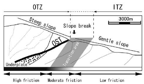
Changes in plate boundary faults and geological structures
|
Plate boundary faults, which cause large trench earthquakes, are thought to have different slippage (friction) at different locations. We investigated how such spatially varying friction affects the geological structure of subduction zones.
We found that as plate boundary faults become deeper, they become less slippery (increased friction), leading to the formation of special large-scale faults called 'out-of-sequence thrusts'.
The physical properties of plate boundary faults (e.g. seismicity) can be inferred from geological structures such as out-of-sequence thrusts observed in the Nankai Trough and other areas. See: Miyakawa et al. (2010) |
|